Telepix transforms satellite utilization with space-based AI
Commercializing research from its role in Cheollian satellite development into a growing private space startup
On-orbit AI processor for real-time image processing… AI CubeSat for blue carbon monitoring
World-first development of three core products: specialized AI agents for satellite data analysis
Exporting cameras for Hungary’s national satellite
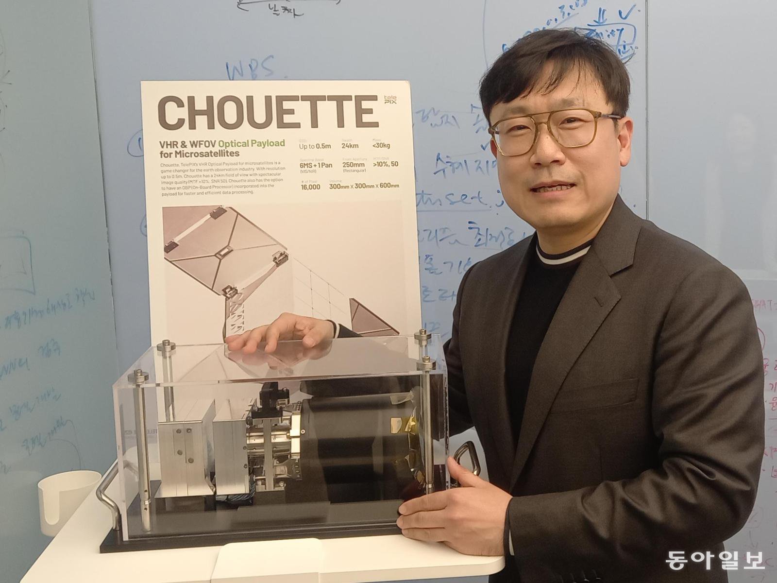
CEO Cho Sung-ik explains the optical payload to be mounted on the AI cubesat “BlueBON” at TelePIX’s office in Yeouido, Yeongdeungpo District, Seoul. Photo by reporter Hur Jin-seok jameshur@donga.com
Past midnight, a lone researcher was staring at a monitor. On the day of North Korea’s artillery bombardment of Yeonpyeong Island in 2010, Cho Sung-ik, then a researcher at the Korea Institute of Ocean Science and Technology (KIOST) Ocean Satellite Center, was examining satellite images of Yeonpyeong Island captured by the Chollian-1 satellite. The screen had precisely captured scenes of smoke rising with an interval of one hour. “A national satellite that cost KRW 350 billion in development expenses has captured such images, yet right now I am the only one looking at them.” He thought that if anyone could utilize satellite imagery, it would reduce tax waste and create many new opportunities. That night, the seed of TelePIX quietly took root. Meeting at TelePIX’s Yeouido office in Yeongdeungpo District, Seoul, in January this year, CEO Cho Sung-ik (48) said, “Since 2021 I have been leading TelePIX, which has become the only company in Korea to possess full life cycle satellite technologies, ranging from optical payloads — the ‘eyes’ of satellites — to artificial intelligence (AI)-based satellite imagery big data analysis software,” adding, “I want to bring forward an era in which individuals can use satellites like personal computers.”
● End of the era when KRW 350 billion satellite imagery was seen by one person alone
For a long time, artificial satellites were the exclusive domain of states. Satellite imagery was an information asset used only by intelligence agencies and specific government ministries. Cho, however, approached the issue from a different angle. Large private companies today pay high fees to use satellite images, but he believed that if many more users could access them, the potential to generate economic added value would be much greater.
This is precisely the problem TelePIX aims to solve: popularization and democratization of satellite utilization. Satellite imagery is already being used, but the analysis is weak in Cho’s assessment. In fact, officials at government agencies complain that “decision-makers want analysis results, not satellite images.” Field practitioners also report the difficulty that “as satellite data increases, workload rises, but manpower is absolutely insufficient.” As demand for satellite data grows in areas such as agriculture, logistics, and climate monitoring, the use of satellites is expanding from being government-centered to involving the private sector.
● Three core technologies that set successive world firsts
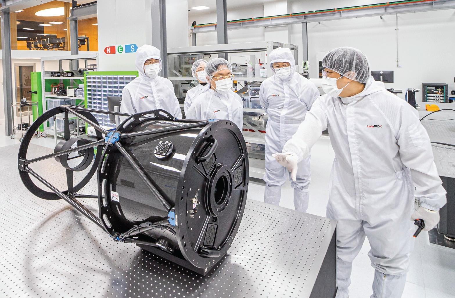
At TelePIX’s Space Lab clean room, a next-generation satellite optical payload development facility in Daejeon, CEO Cho Sung-ik (center) and employees examine a large collimator used for assembly, alignment, and performance testing of optical components and systems. Courtesy of TelePIX
TelePIX’s technological competitiveness is concentrated in three core products. The first is the world’s first spaceborne onboard edge AI processor, “TetraPLEX.” Traditionally, to process images captured by satellites, data had to be transmitted to a ground station for analysis, a process that took at least six minutes. TetraPLEX incorporates a triple-redundant architecture of a graphics processing unit (GPU), central processing unit (CPU), and field-programmable gate array (FPGA), enabling AI-based image analysis directly in space. It has reduced image processing time to one thirty-fifth of the previous level. This technology was launched into space aboard SpaceX’s reusable launch vehicle Falcon 9 in August 2024 and subsequently operated normally in orbit for more than 15 months. It was also listed in NASA’s “2024 State of the Art of Small Spacecraft Technology” report.
The second weapon is the AI cubesat “BlueBON.” Successfully launched in 2025, BlueBON is the world’s first AI cubesat dedicated to monitoring blue carbon (carbon sinks in marine ecosystems). It carries a self-developed multispectral optical payload along with TetraPLEX. BlueBON drew global attention in early July last year with a report analyzing images it captured in June of an airstrike on Iran’s Isfahan nuclear facility, conducted by the United States. In the same year, TelePIX signed a contract worth USD 300,000 with a Polish satellite company for European imagery sales rights, marking the first export of cubesat imagery by a Korean company.
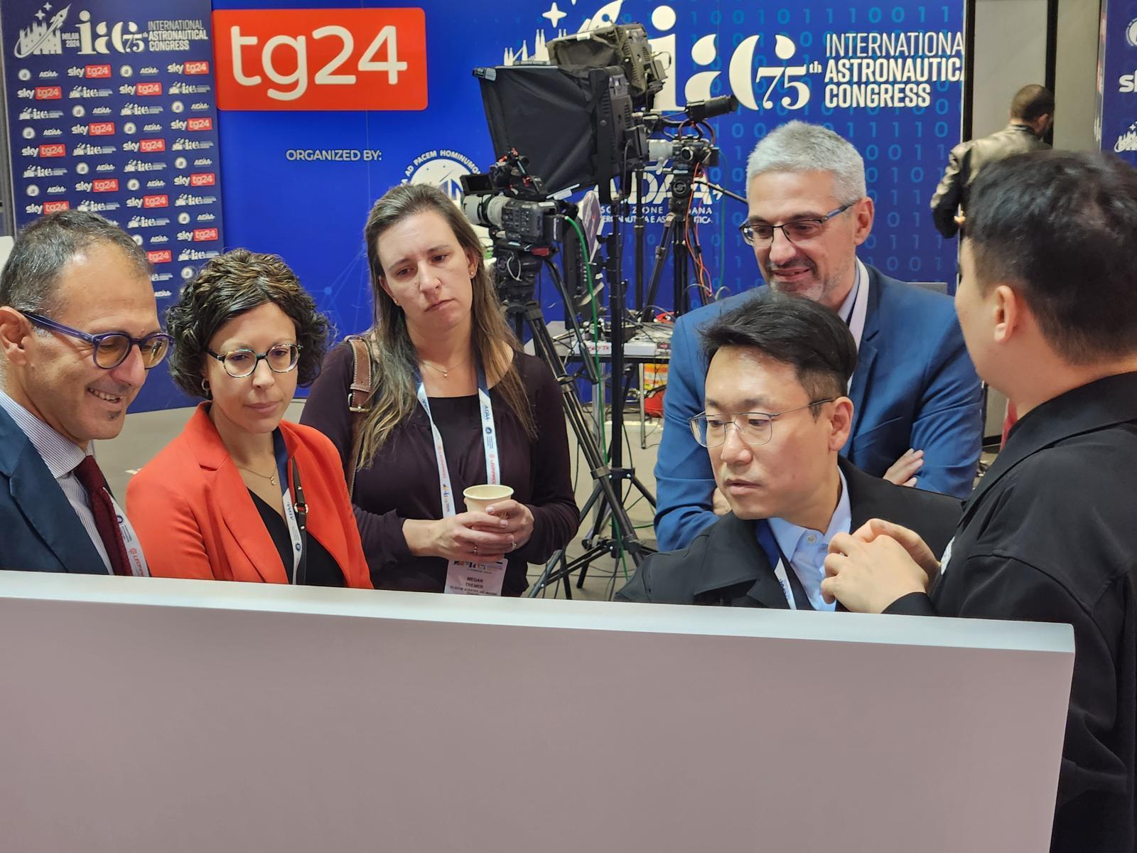
At the 75th International Astronautical Congress (IAC) in Milan, Italy, in 2024, CEO Cho introduces “SatCHAT,” an AI agent solution specialized in satellite data analysis, to overseas space industry stakeholders. Courtesy of TelePIX
The third core product is “SatCHAT,” the world’s first AI agent specialized in satellite data analysis. Like ChatGPT, users can query it in natural language, and it automatically handles everything from satellite imagery search and analysis to report generation. Previously, it took two to five days from satellite imagery discovery to completion of an analysis report; SatCHAT completes this entire process within minutes, saving more than 95% of the time. Last year, TelePIX signed its first large-scale supply contract with a major Korean government agency, demonstrating its commercial potential.
Last month, TelePIX also signed a contract to supply a high-resolution electro-optical (EO) camera system worth tens of millions of dollars to the Hungarian government’s national Earth observation satellite program (HULEO). Having secured this deal in fierce competition with Europe’s largest satellite manufacturers, the company achieved the first case of a private firm commercially exporting to Europe technology that had been transferred from the Korea Aerospace Research Institute. Cho explained its significance by saying, “By directly grinding and manufacturing optical lenses, TelePIX has acquired technology that has now enabled full-fledged participation in European state-led satellite programs.”
● From gazing at stars to looking at Earth: from researcher to founder
Cho completed both his bachelor’s and master’s degrees in Astronomy and Space Science at Yonsei University and finished his doctoral coursework. Under an advisor who had been developing satellites with NASA in graduate school, he learned astronomical observation instrument design and data analysis.
After joining KIOST in 2006, he spent 15 years experiencing firsthand the entire process of satellite development and operation. Seconded to Airbus in France, he participated in developing the ocean payload for Chollian-1 (2007–2008), and after its successful launch in June 2010, he led satellite operations and services as head of the Ocean Satellite Center. From 2013 to 2017, when he moved again to France for the development of Chollian-2, he witnessed the explosive growth of private space startups in Europe and the United States. “In the US and Europe, private companies were emerging. That was when I got the hint that this could become a business,” Cho said. The idea he had long harbored was crystallizing into a firm decision.
He invested his severance pay and other funds to acquire TelePIX, which had been founded in 2019, in 2021. The business did not proceed smoothly after the acquisition. Space is an industry that requires long development periods and massive capital, and in the domestic startup ecosystem, space remained a relatively unfamiliar field. The gap in financing conditions was a constant hurdle to overcome.
He placed his bet on a vertical integration strategy. Experts with an average of more than 17 years of experience in satellite system development at institutions such as the Korea Aerospace Research Institute and the Agency for Defense Development joined the company. By internalizing the entire value chain — from optical cameras, the “eyes” of satellites, and AI processing chips to satellite operations and imagery analysis software — TelePIX secured both quality and cost competitiveness. This strategy bore fruit by passing stringent European certifications and winning in international tenders.
● Toward the era of ‘PC-ization’ of satellites TelePIX has passed the technical evaluation for a special technology listing on KOSDAQ and is preparing for an initial public offering. Approximately 90 employees at its headquarters in Yeouido, Seoul, and its R&D base in Daedeok, Daejeon, are focused on AI model development and satellite hardware manufacturing. In 2024, the company was selected as a Technology Pioneer by the World Economic Forum (WEF), won an Innovation Award at the US IT and consumer electronics exhibition CES, and last year was chosen for the NVIDIA Inception Program and the Amazon Web Services (AWS) Space Accelerator, gaining global recognition.
However, a continuing challenge is to secure technological differentiation while competing against global satellite companies. “TelePIX will grow into a vertically integrated company that can produce satellites at one-fifth of the conventional cost of national satellites, as a rare player at the forefront of a new market that merges AI and satellites and holds both hardware and software capabilities,” Cho said.
The future Cho envisions is an era in which satellites become personal tools like PCs. “Just as PCs followed mainframe computers, a time will surely come when satellites are available for everyone to use,” he said, adding, “The fact that the resubscription rate of satellite imagery subscription customers in the United States exceeds 97% is clear evidence of how strong the demand for satellite imagery is.”
ⓒ dongA.com. All rights reserved. Reproduction, redistribution, or use for AI training prohibited.
Popular News