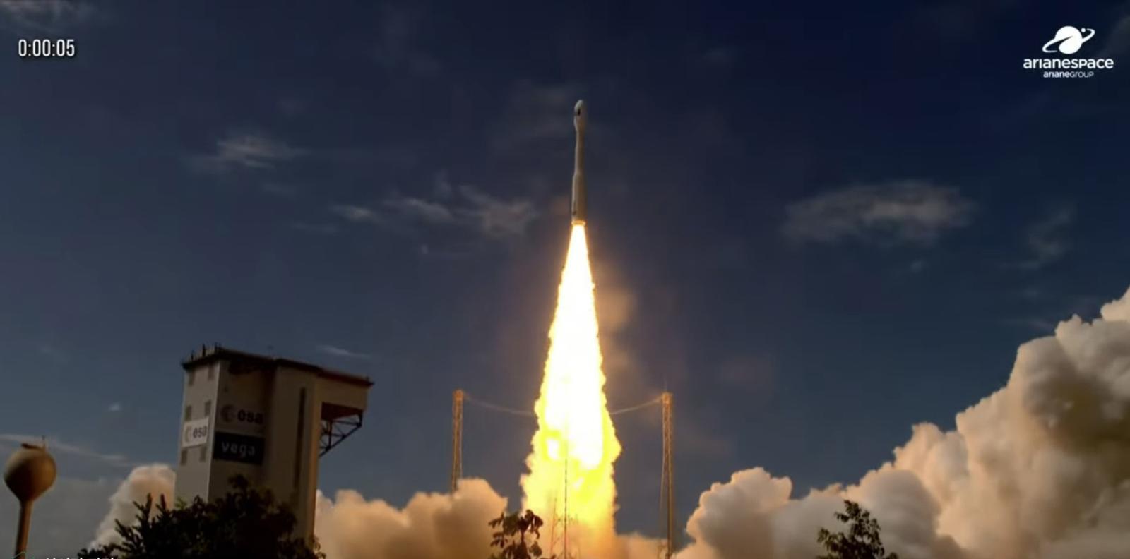
The high-resolution observation satellite Arirang 7, developed with domestic technology, was launched at 2:21 a.m. (Korean time) on December 2 from the Guiana Space Center in Kourou, French Guiana, South America, aboard the Arianespace Vega-C. Arirang 7 is equipped with a domestically developed 0.3m-class high-resolution optical camera (AEISS-HR). The resolution of the new optical camera is more than three times improved in readability compared to the existing Arirang 3A (optical 0.55m), allowing identification of vehicle types (such as small cars and trucks). (Arianespace YouTube screen capture. Resale and DB prohibited) 2025.12.2 (Seoul=News1)
The high-resolution observation satellite Arirang 7, developed with domestic technology, successfully made its first communication after launch.
The Aerospace Agency announced on December 2 at 3:30 a.m. (Korean time) that it succeeded in initial communication with the Antarctic Troll Ground Station.
The Aerospace Agency also explained, "We have confirmed the status of the satellite, including the deployment of Arirang 7's solar panels."
Arirang 7 was launched into space at 2:21 a.m. from the Guiana Space Center in Kourou, French Guiana, South America, aboard the Arianespace Vega-C.
After separating from the payload 43 minutes and 54 seconds post-launch, it settled into orbit and successfully completed its first communication. The Aerospace Agency plans to attempt a total of four communications before making a final announcement on the success of the satellite launch.
Arirang 7 is a multipurpose practical satellite equipped with a domestically developed 0.3m-class high-resolution optical camera (AEISS-HR). It is scheduled to conduct precise observations of the Korean Peninsula from a 500 km low Earth orbit in a sun-synchronous orbit for five years.
The resolution of the new optical camera is more than three times improved in readability compared to the existing Arirang 3A (optical 0.55m), allowing identification of vehicle types (such as small cars and trucks).
Through this, it plans to respond to various public sector satellite image demands such as disaster, national land, resource, and environmental monitoring, and provide world-class high-quality satellite images to public and private sectors.
ⓒ dongA.com. All rights reserved. Reproduction, redistribution, or use for AI training prohibited.
Popular News